The following pictures are from around a butte (HCB) at the top of Hog Canyon Road and from a complex of interdune deposits NW of the intersection Hwy 89 and Angel Canyon Road (ACR). The ACR area appears to me to hold the potential for discovery of many more tracks. The photos were taken in May 2017.
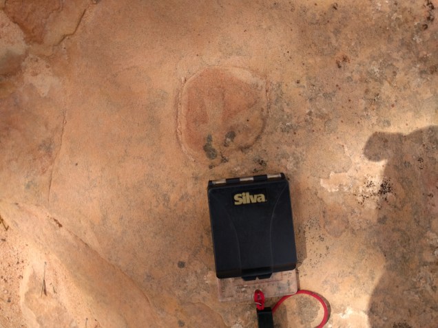
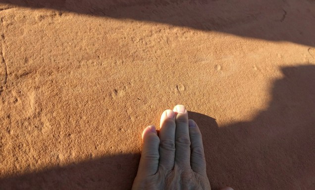
Tiny tracks on water-rippled sandstone. Swimming tracks? Hog Canyon Butte (HCB) Specimen in my possession. Photo ID: HCB 1
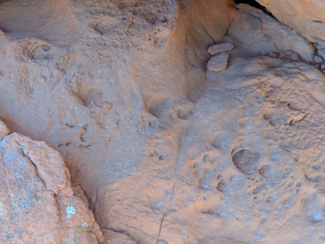
Another
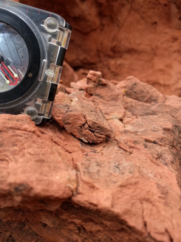
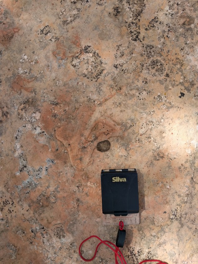
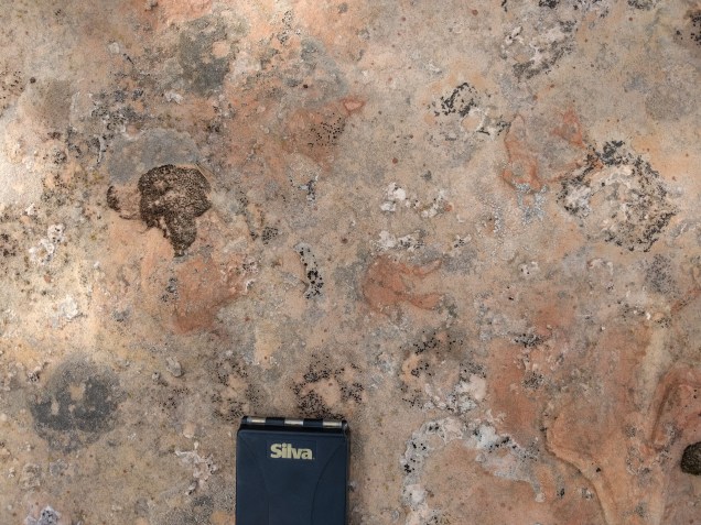
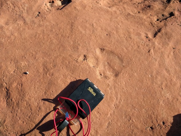
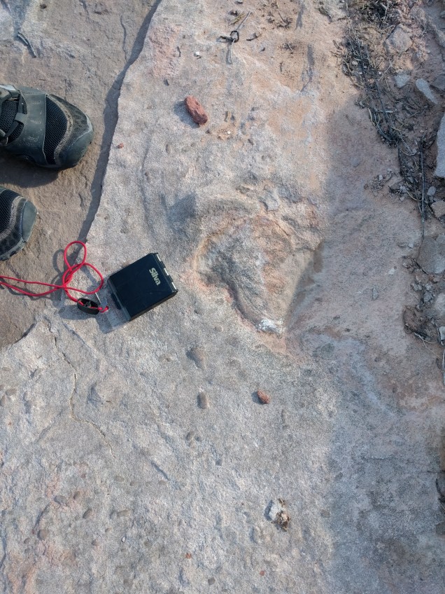
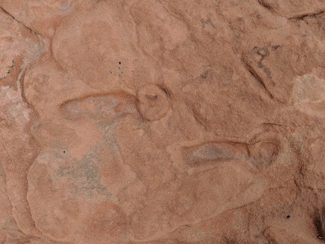
Bioturbation. HCB 2. Specimen in my possession.Burrow? I wonder if it could be a modern creation because of its location on a fracture. Perhaps this feature was formed by a modern root infiltrating along a fracture in the rock before the outer block fell away. HCB 3Burrow. If this is, indeed, a burrow, it would be my most exciting find so far. I have not determined definitively whether this is biogenic or not. HCB 4Have no idea what this is. HCB 6
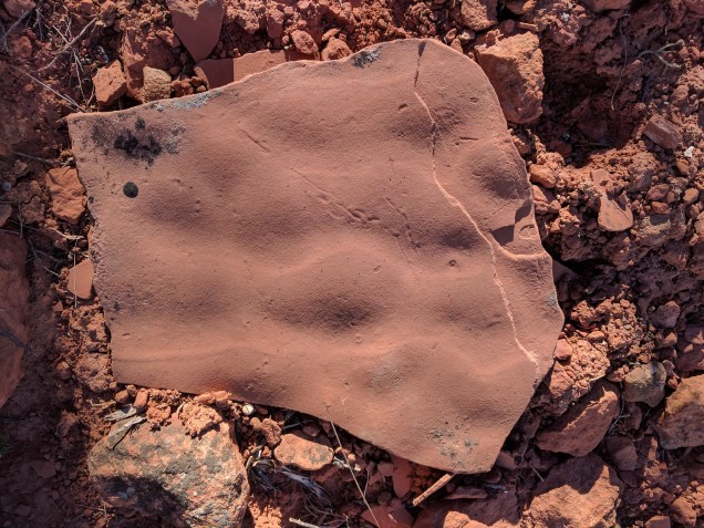
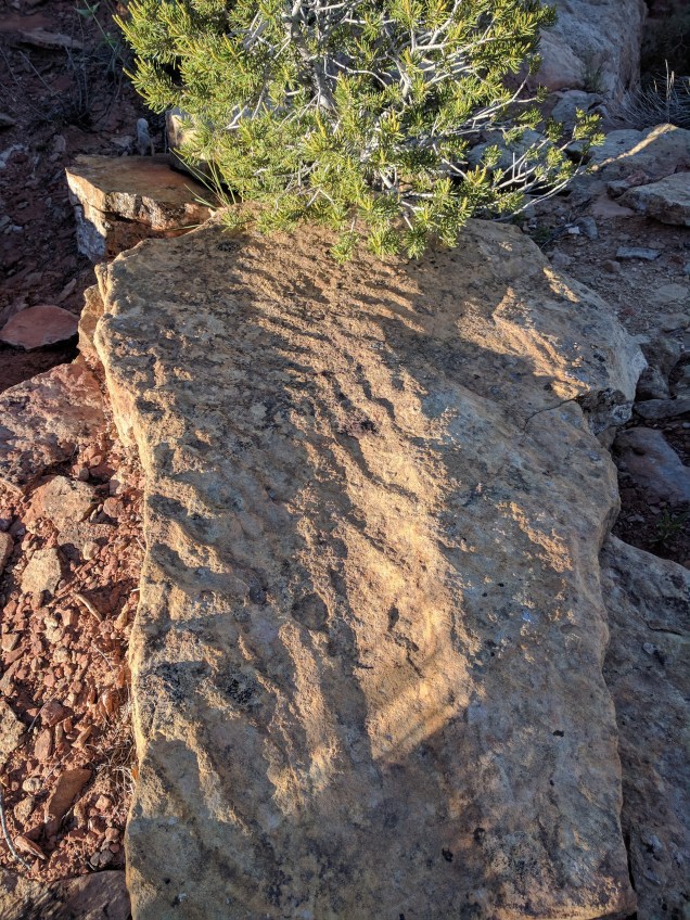
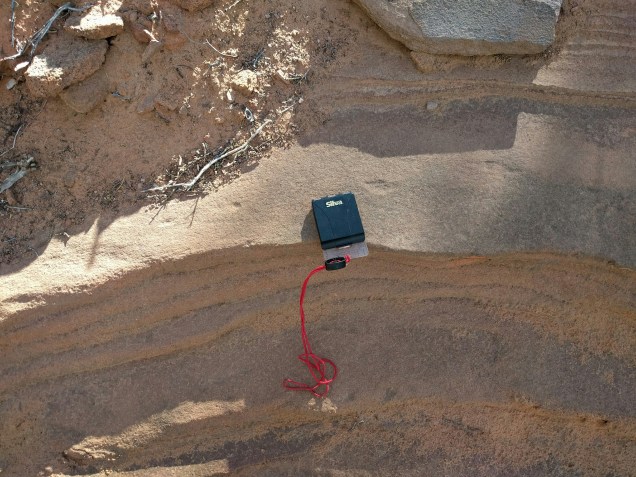
Water formed ripples. Clear evidence of surface water in the Navajo Erg. HCB 7
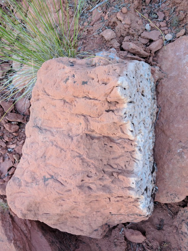
Another bit of evidence of surface water. This block was near the one pictured in HCB 7. There were several blocks in this vicinity showing obvious water ripples. HCB 8
Angel Canyon Road
The photos below were taken near the intersection of Angel Canyon Road and Hwy 89 near Kanab, UT. Visible from the intersection are multiple exposures of interdune deposits stacked one above the other on both sides of the highway. I figured it would be good track prospecting. I was pointed to the site by Gerald Bryant of the Colorado Plateau Institute.
In May, 2016, Talking Rocks Tours visited Valley of Fire State Park outside Las Vegas. We were there to examine a massive overthrust, paleozoic rocks pushed up and over the Jurassic Aztec Sandstone (an extension of the Navajo Sandstone formation). Our geologist, Gerry Bryant hiked us out to a good exposure of the overthrust, pausing along the way to examine some petrified logs. The next morning before the rest of camp was up and about, I was clambering about on the rocks near Atlatl Rock and found this track way.
Valley of Fire tracks. VF 1
The next year, 2017, I returned to Valley of Fire and searched for this trackway, but could not find it. Instead, I found this.
Boulder with tracks on two levels. VF 2
A three-print trackway on the boulder in the center. Below is a close up of the middle print.
VF 3
I returned in April, 2018, with my wife, Karin, and again looked for the original trackway that drew me to this site. Again I was unable to find it. But we found multiple other tracks. For example on the large block above, there is a six or seven print trackway on a layer about half a meter (stratigraphically) below the trackway pictured. The block has split several inches along a bedding plane so one can trace the trackway on the hidden surface.
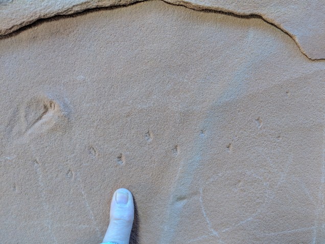
Two different animals. Ichno species unknown to me. The tiny tracks also show up on surfaces exhibiting therapod tracks.
Tiny tracks with some larger tracks. VF 4
Stephen Rowland, of UNLV, examined the tracks above on May 7, 2018. He said the little animal is known from other Navajo SS track sites in Nevada, but not further east in Utah. These may be the best exemplars of this track known to date. I wonder if continued research will confirm that the range of these little animals was limited to the western (using current geography) edge of the Navajo Erg. If so, what else would this indicate about the paleo environment.
Curious tracks, total length about three inches, if I remember right. VF 5
Most of the tracks are on fallen blocks (allochthonous). But they appear to have come from very close at hand. And some of the tracks are on in situ material.
All of the tracks appear to be above a laterally extensive zone of deformation. For example, the layers below the tiny prints appear to have had much of their structure effaced by fluidization for a depth of approximately 3 meters. This alteration of the original dune structure is visible on the side of the block.
The most dramatic example of track/soft sediment deformation interaction is below. This appears to me to be tracks of a therapod and the Track 2 animal (above) on a soupy surface. (Soupy–now there’s a scientific term for you.) My interpretation of this surface is subject to review by Gerry Bryant who is famous for correcting my theories and by Stephen Rowland. (Update: Rowland found these “tracks” highly dubious.)
The saturated, disturbed surface that appears to be the lower limit for any tracks. All tracks that I found were formed in or above this layer. VF 6
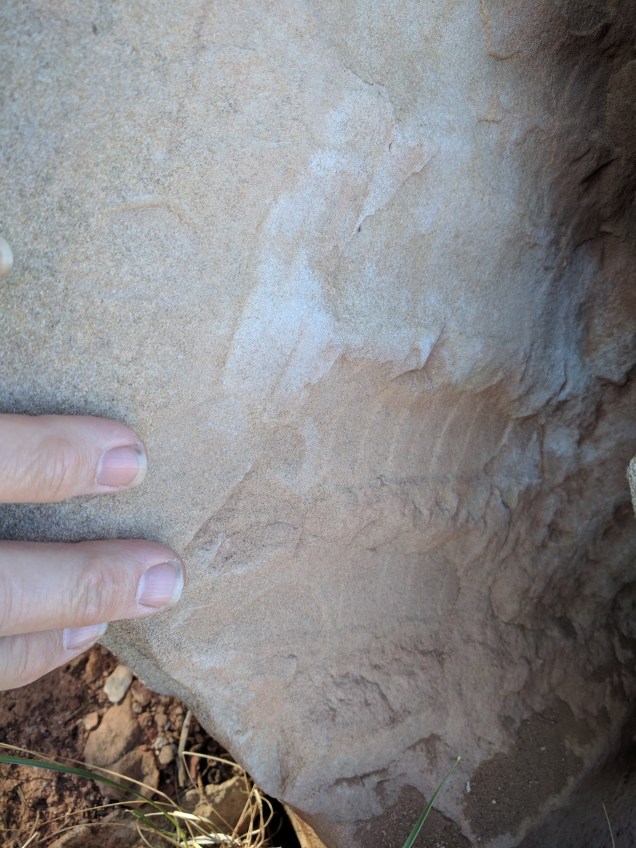
The photo below raises questions about dune structure and alteration. The wavy lines appear to run perpendicular to the dip of the original dune face. The structure they express is a very thin layer perhaps only two or three grains thick. I observed the same phenomenon in the Coconino Sandstone in the neighborhood of the tracks along the Hermit Trail in Grand Canyon. I think the wavy lines are created by the surface moving as a unit above the underlying (and undisturbed) layer. Does this happen because the surface layer somehow gets saturated with water and develops a consistency very different from the substrate? Does this happen because this is an avalanche layer and is fluffy with air?
Wavy lines perpendicular to the apparent original dip of the dune slope. Similar in appearance to features in the Coconino SS along the Hermit Trail in Grand Canyon in the neighborhood of the tracks there. VF 7.
The photo below is just meant to tantalize you and get you out of your chair to go prospecting for tracks. It is a single track about half mile north of the track area near Atlatl Rock. In the neighborhood, I found a few other isolated tracks and the predictable evidence of interdune wetlands. Not enough to call it a site, but enough to hint that there are lots more tracks in Valley of Fire waiting for dinosaur hunters.
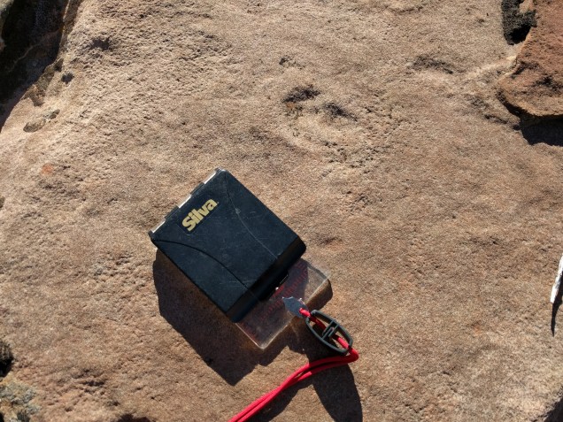
Isolated therapod track half mile north of Atlatl Rock. VF 8.