The following pictures are from around a butte (HCB) at the top of Hog Canyon Road and from a complex of interdune deposits NW of the intersection Hwy 89 and Angel Canyon Road (ACR). The ACR area appears to me to hold the potential for discovery of many more tracks. The photos were taken in May 2017.
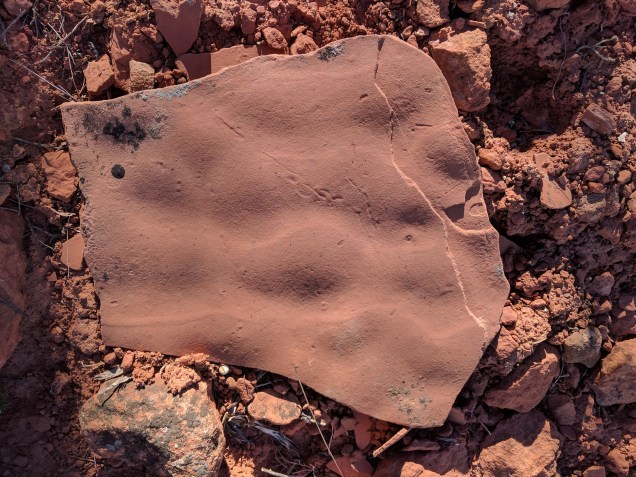
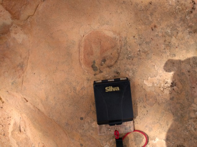
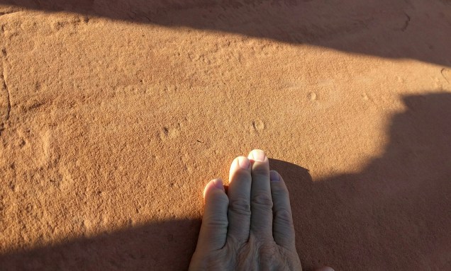
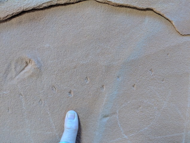
Tiny tracks on water-rippled sandstone. Swimming tracks? Hog Canyon Butte (HCB) Specimen in my possession. Photo ID: HCB 1
Another
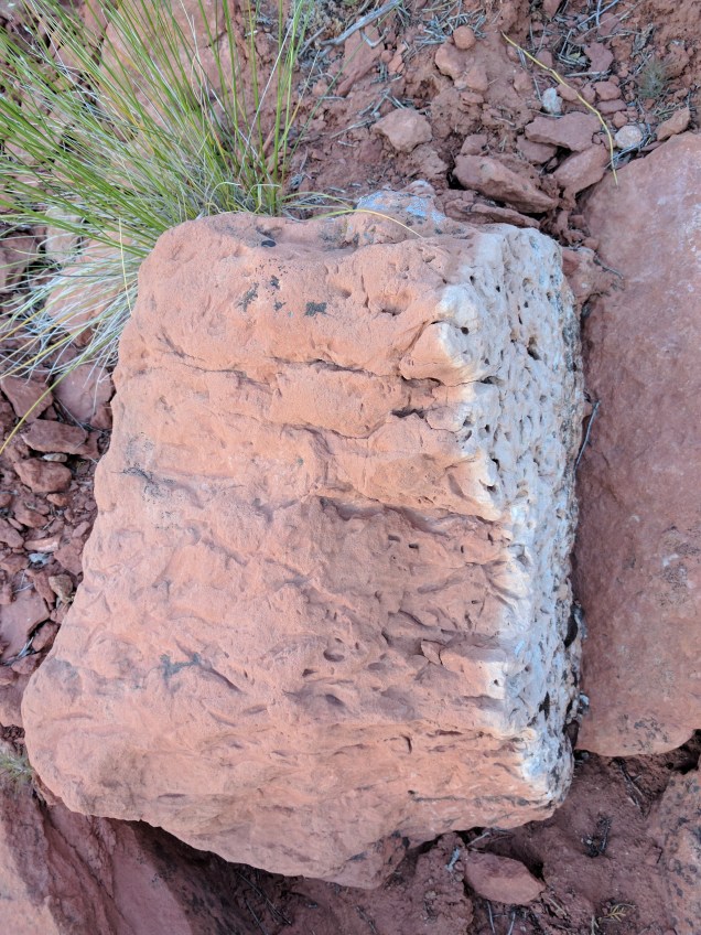
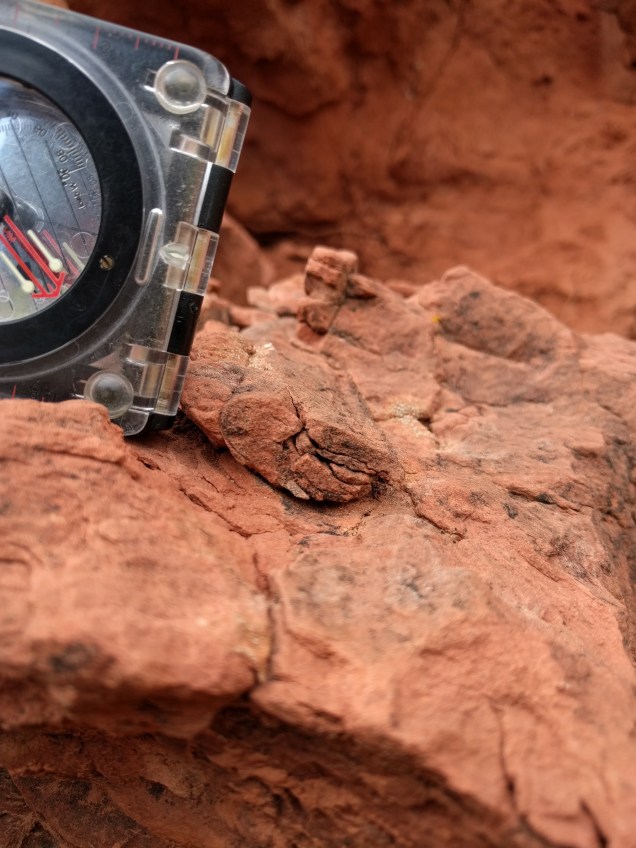
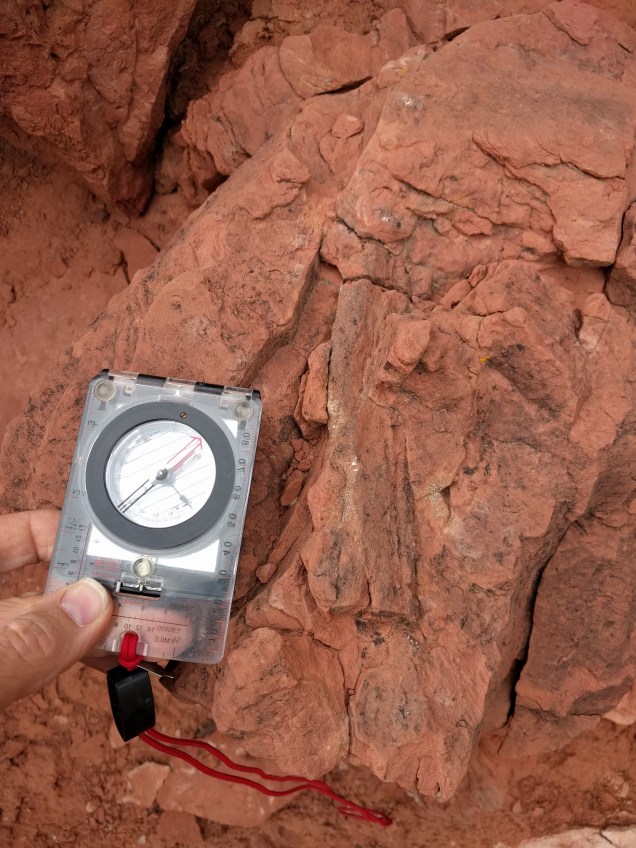
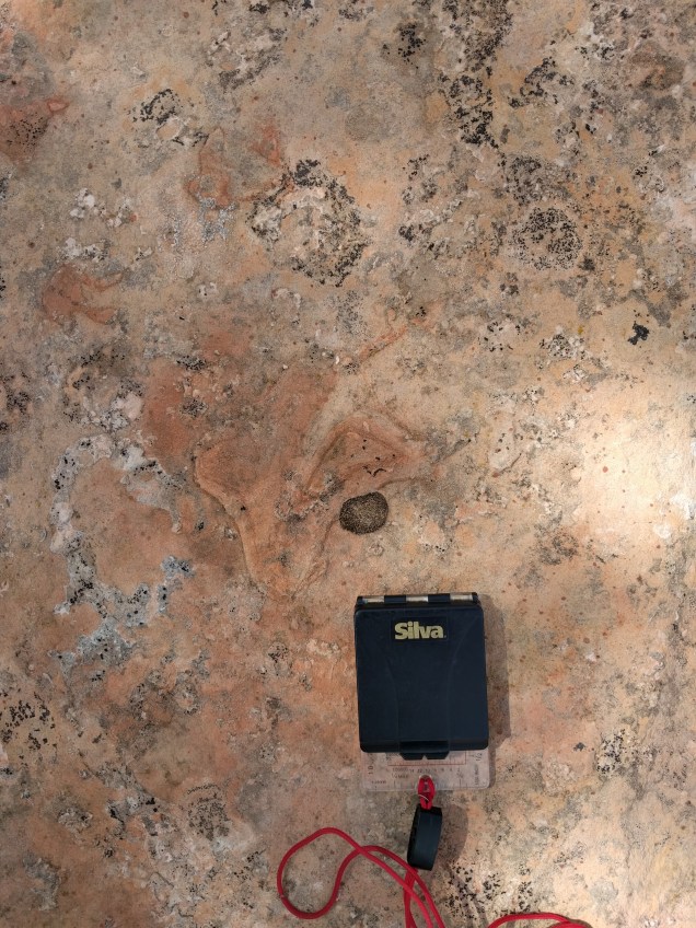
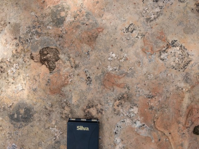
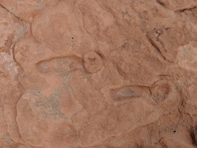
Bioturbation. HCB 2. Specimen in my possession.Burrow? I wonder if it could be a modern creation because of its location on a fracture. Perhaps this feature was formed by a modern root infiltrating along a fracture in the rock before the outer block fell away. HCB 3Burrow. If this is, indeed, a burrow, it would be my most exciting find so far. I have not determined definitively whether this is biogenic or not. HCB 4Have no idea what this is. HCB 6
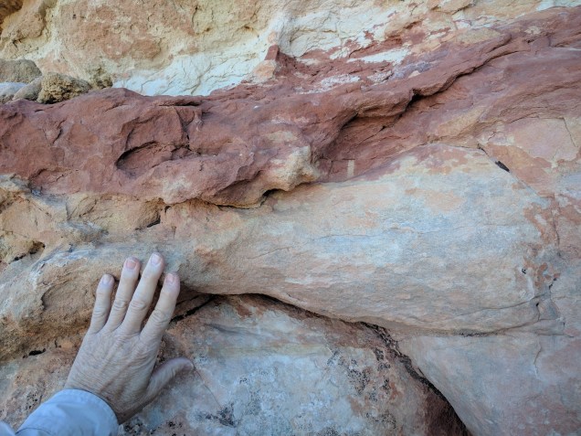
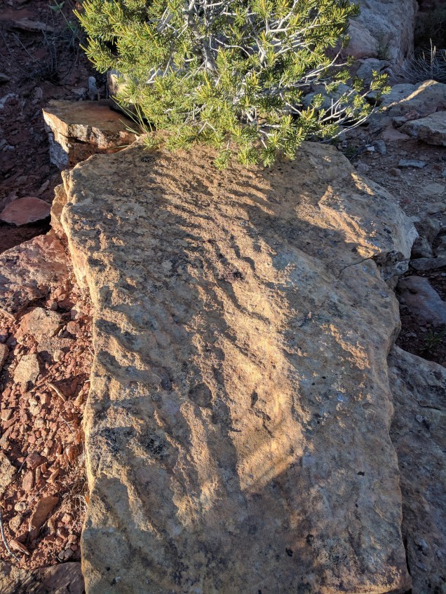
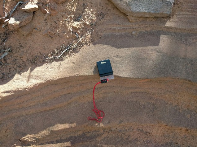
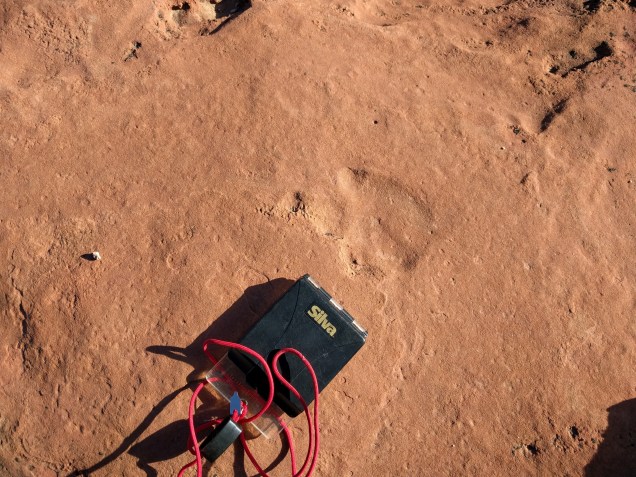
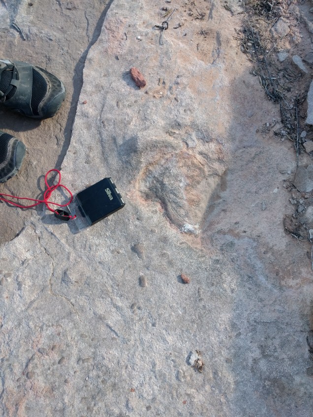
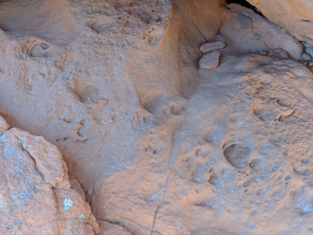
Water formed ripples. Clear evidence of surface water in the Navajo Erg. HCB 7
Another bit of evidence of surface water. This block was near the one pictured in HCB 7. There were several blocks in this vicinity showing obvious water ripples. HCB 8
Angel Canyon Road
The photos below were taken near the intersection of Angel Canyon Road and Hwy 89 near Kanab, UT. Visible from the intersection are multiple exposures of interdune deposits stacked one above the other on both sides of the highway. I figured it would be good track prospecting. I was pointed to the site by Gerald Bryant of the Colorado Plateau Institute.
In May, 2016, Talking Rocks Tours visited Valley of Fire State Park outside Las Vegas. We were there to examine a massive overthrust, paleozoic rocks pushed up and over the Jurassic Aztec Sandstone (an extension of the Navajo Sandstone formation). Our geologist, Gerry Bryant hiked us out to a good exposure of the overthrust, pausing along the way to examine some petrified logs. The next morning before the rest of camp was up and about, I was clambering about on the rocks near Atlatl Rock and found this track way.
Valley of Fire tracks. VF 1
The next year, 2017, I returned to Valley of Fire and searched for this trackway, but could not find it. Instead, I found this.
Boulder with tracks on two levels. VF 2
A three-print trackway on the boulder in the center. Below is a close up of the middle print.
VF 3
I returned in April, 2018, with my wife, Karin, and again looked for the original trackway that drew me to this site. Again I was unable to find it. But we found multiple other tracks. For example on the large block above, there is a six or seven print trackway on a layer about half a meter (stratigraphically) below the trackway pictured. The block has split several inches along a bedding plane so one can trace the trackway on the hidden surface.
Two different animals. Ichno species unknown to me. The tiny tracks also show up on surfaces exhibiting therapod tracks.
Tiny tracks with some larger tracks. VF 4
Stephen Rowland, of UNLV, examined the tracks above on May 7, 2018. He said the little animal is known from other Navajo SS track sites in Nevada, but not further east in Utah. These may be the best exemplars of this track known to date. I wonder if continued research will confirm that the range of these little animals was limited to the western (using current geography) edge of the Navajo Erg. If so, what else would this indicate about the paleo environment.
Curious tracks, total length about three inches, if I remember right. VF 5
Most of the tracks are on fallen blocks (allochthonous). But they appear to have come from very close at hand. And some of the tracks are on in situ material.
All of the tracks appear to be above a laterally extensive zone of deformation. For example, the layers below the tiny prints appear to have had much of their structure effaced by fluidization for a depth of approximately 3 meters. This alteration of the original dune structure is visible on the side of the block.
The most dramatic example of track/soft sediment deformation interaction is below. This appears to me to be tracks of a therapod and the Track 2 animal (above) on a soupy surface. (Soupy–now there’s a scientific term for you.) My interpretation of this surface is subject to review by Gerry Bryant who is famous for correcting my theories and by Stephen Rowland. (Update: Rowland found these “tracks” highly dubious.)
The saturated, disturbed surface that appears to be the lower limit for any tracks. All tracks that I found were formed in or above this layer. VF 6
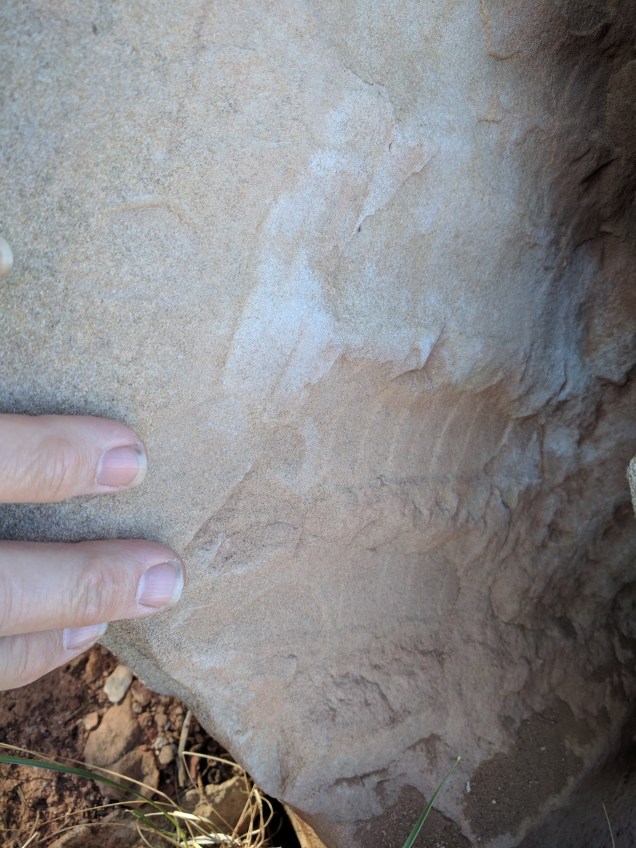
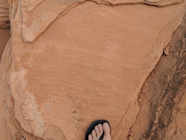
The photo below raises questions about dune structure and alteration. The wavy lines appear to run perpendicular to the dip of the original dune face. The structure they express is a very thin layer perhaps only two or three grains thick. I observed the same phenomenon in the Coconino Sandstone in the neighborhood of the tracks along the Hermit Trail in Grand Canyon. I think the wavy lines are created by the surface moving as a unit above the underlying (and undisturbed) layer. Does this happen because the surface layer somehow gets saturated with water and develops a consistency very different from the substrate? Does this happen because this is an avalanche layer and is fluffy with air?
Wavy lines perpendicular to the apparent original dip of the dune slope. Similar in appearance to features in the Coconino SS along the Hermit Trail in Grand Canyon in the neighborhood of the tracks there. VF 7.
The photo below is just meant to tantalize you and get you out of your chair to go prospecting for tracks. It is a single track about half mile north of the track area near Atlatl Rock. In the neighborhood, I found a few other isolated tracks and the predictable evidence of interdune wetlands. Not enough to call it a site, but enough to hint that there are lots more tracks in Valley of Fire waiting for dinosaur hunters.
Isolated therapod track half mile north of Atlatl Rock. VF 8.
Here’s how we tell our story: 6000 years ago God created Adam and Eve and the garden and the animals and plants and sky and ground and sun and moon and stars. This was the creation of the entire cosmos–everything. (The word “universe” had not yet been invented.) Adam and Eve messed up. Life became hard. But God promised to birth another Adam who would fix our world and inaugurate a Messianic age when everything will be lovely. This is how our story has been told for 2,000 years. If you had asked Jesus whether Genesis One referred to the creation on Earth or the solar system or the Milky Way Galaxy he would have stared at you blankly. If you had asked Paul if the deadly effect of Adam’s sin applied to planets circling other sun’s in other galaxies, he would not have been able to understand the question.I He knew nothing about solar system or galaxies or black holes. But we do. So we have edited our story. Now or story behind billions of years ago with the creation of galaxies and suns and our very own solar system. Our cosmos is larger than Earth and sun and Moon. In our universe, an entire galaxy can slide into a black hole and we remain untouched unchanged, not helped, not affected. We are aware it happened. Still, the obliteration of an entire galaxy does not merit a single sentence in our religious story. The death of a galaxy is irrelevant to our religion.
The grand and awful reality of a galactic death does not diminish our story. The billions of years hiding in the night sky does not diminish the art and drama and pathos of our births and romance and wat and making and creating and living and dying. Human reality and Christian reality is not made trivial by the facts of astronomy. But then neither does the intense drama and pathos of our story efface the reality of extra-galactic happenings or the reality of the geologic processes that built the ground under our feet.
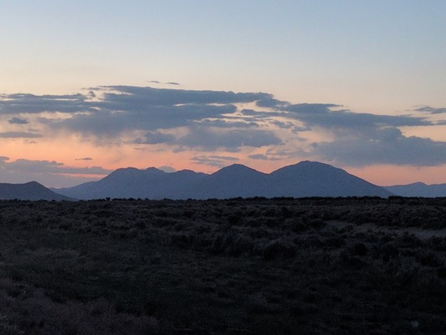
A few days ago I went running in the hills east of Salt Lake City. From a splendid overlook, my eyes ran West toward the setting sun, sweeping across the 20 mile valley occupied by the city to the mountains to the west and then to the Northwest, where my eyes could run west across the water of the Great Salt Lake all the way to where the sky came down to earth. The mountain I stood on and the mountain I saw rising out of the flatland across the valley were both flat lands eons ago. This entire neighborhood–hundreds of thousands of square miles–was flat as a pancake back then, by turns it was soft oozy mud or wind-blown sand. In that world there were no humans, no dogs and cats, no bears or camels, no roses or strawberries, no dolphins or trout. All this sediment turned to rock. Mysterious forces beneath the pancake layers of mud and sand turned into brittle rock–shale, limestone, and sandstone–fractured the pancake into pieces like massive ice flows, icebergs of rock on a magma sea. The bergs tilted, dropping one edge, raising the other. The raised edges became the mountains in this neighborhood. The trailing dripping edges were buried under thousands tens of thousands of feet of former mountain sluiced off the rising edges as they rose. These heaving mountains–and they are still moving–are the stage on which our story is played. The immense valleys in this neighborhood were constructed over years beyond comprehension. These valleys are not part of our story–no more than a stage is part of the plot of a play. These mountains and valleys are no less real than the stage for a great production. But their creation is not part of our religious story. We can easily ignore the stage while attending to the story being performed. In fact, that’s intended. The director does not want you to think about the floor and backdrop and chandeliers and carpet. It is the story on stage that is supposed to engage us. The story of the building of the theater and the story on stage are different stories all together. Both worth telling, but not to be confused.
The view west across Salt Lake City pulls my mind outward across both space and time. The sweeping miles of space are immediately obvious. This place is not called “viewpoint” for no reason. The eons of time are only slightly less obvious for a student of the rocks. The mountains here (in the region called the basin and range) are the upper edges of chunks of Earth’s crust that have tilted, raising one edge, dropping the other. The valleys are thousands–sometimes tens of thousands–of feet of sediment sluiced of the mountains as they rose. 20,000 years ago this place was so wet the entire flat land visible in the photo was under water–Lake Bonneville. That much rain ate at the mountains, biting their tops off as they rose. I see this same mountain-eating process in the wet mountains east of my house near Mt. Rainier. But even deluges take some time to eat mountains. Chewing 10K or 20K feet off a rising mountain takes some time. And lifting the edge of a piece of Earth’s crust 30K feet also takes some time. So, looking across the Salt Lake valley is looking across the time it took to lift the rocks in these mountains from their original flat to their present verticality. And there is more. The mountain Gus is standing on is made of limestone (at least the part right under his feet.) That limestone was created by accumulating lime sediment in a sea that used to exist here. After it accumulated, it needed time to turn to stone. And this accumulation and lithification had to happen before the crust on this region could be broken into pieces and tipped to form mountains that could be eroded to fill the valley before becoming a lake before drying out and turning the top of the valley into salt flats.
All this is on display from the Pipeline Trail Viewpoint above Mill Creek Canyon.


 ere’s how we tell our story: 6000 years ago God created Adam and Eve and the garden and the animals and plants and sky and ground and sun and moon and stars. This was the creation of the entire cosmos–everything. (The word “universe” had not yet been invented.) Adam and Eve messed up. Life became hard. But God promised to birth another Adam who would fix our world and inaugurate a Messianic age when everything will be lovely. This is how our story has been told for 2,000 years. If you had asked Jesus whether Genesis One referred to the creation on Earth or the solar system or the Milky Way Galaxy he would have stared at you blankly. If you had asked Paul if the deadly effect of Adam’s sin applied to planets circling other sun’s in other galaxies, he would not have been able to understand the question.I He knew nothing about solar system or galaxies or black holes. But we do. So we have edited our story. Now or story behind billions of years ago with the creation of galaxies and suns and our very own solar system. Our cosmos is larger than Earth and sun and Moon. In our universe, an entire galaxy can slide into a black hole and we remain untouched unchanged, not helped, not affected. We are aware it happened. Still, the obliteration of an entire galaxy does not merit a single sentence in our religious story. The death of a galaxy is irrelevant to our religion.
 The view west across Salt Lake City pulls my mind outward across both space and time. The sweeping miles of space are immediately obvious. This place is not called “viewpoint” for no reason. The eons of time are only slightly less obvious for a student of the rocks. The mountains here (in the region called the basin and range) are the upper edges of chunks of Earth’s crust that have tilted, raising one edge, dropping the other. The valleys are thousands–sometimes tens of thousands–of feet of sediment sluiced of the mountains as they rose. 20,000 years ago this place was so wet the entire flat land visible in the photo was under water–Lake Bonneville. That much rain ate at the mountains, biting their tops off as they rose. I see this same mountain-eating process in the wet mountains east of my house near Mt. Rainier. But even deluges take some time to eat mountains. Chewing 10K or 20K feet off a rising mountain takes some time. And lifting the edge of a piece of Earth’s crust 30K feet also takes some time. So, looking across the Salt Lake valley is looking across the time it took to lift the rocks in these mountains from their original flat to their present verticality. And there is more. The mountain Gus is standing on is made of limestone (at least the part right under his feet.) That limestone was created by accumulating lime sediment in a sea that used to exist here. After it accumulated, it needed time to turn to stone. And this accumulation and lithification had to happen before the crust on this region could be broken into pieces and tipped to form mountains that could be eroded to fill the valley before becoming a lake before drying out and turning the top of the valley into salt flats.